



Canaryvirtualmap · Interactive virtual city
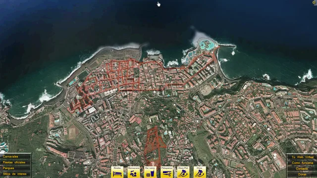
An interactive virtual representation of Puerto de la Cruz: roads, pedestrian routes and local businesses connected through 360° panoramas and immersive navigation.
Project Description
Canaryvirtualmap was my project to represent Puerto de la Cruz as an interactive city, covering roads, pedestrian routes and access to local businesses. It went beyond a tour of a single venue.
The work combined panoramic photography, image preparation, interfaces, linked scenes and 360° navigation using Krpano, HTML, JavaScript and XML, including spherical and little-planet views.
Related work included virtual websites and tours for hotels, restaurants and other spaces in Spain and France. The preserved files support study of a historical restoration; this is not presented as an up-to-date street map.
Main Features
- Interactive representation of Puerto de la Cruz
- Roads and pedestrian routes
- Access to local businesses
- Linked 360° panoramas
- Spherical and immersive views
- Photography and web development